A Bit About Vingings GA
For hundreds of years Vinings was inhabited by Creek, then later by Cherokee, Native Americans, who farmed along the Chattahoochee River.
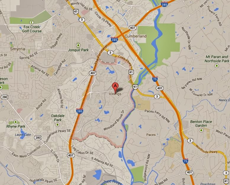
Vinings is a census-designated place and an unincorporated town in Cobb County, Georgia, just across the Chattahoochee River from Atlanta. As of the 2010 census, the town had a total population of 9,734. It is located between the affluent West Paces Ferry section of Buckhead in northwest Atlanta, and suburban Smyrna in Cobb County, adjacent to the Cumberland edge city. The U.S. Postal Service uses "Atlanta" for all Vinings addresses (ZIP code 30339).
Located alongside the Chattahoochee River and a mere ten miles northwest of Downtown Atlanta, Vinings contains the perfect blend of Southern charm and modern day sophistication. Home to over 9600 residents, Vinings is an unincorporated town that was originally known as Crossroads and then Paces back in 1830.
According to the United States Census Bureau, the CDP has a total area of 3.3 square miles, of which 3.2 square miles is land and 0.1 square miles, or 3.34%, is water.
Vinings Subdivisions Include
Avignon at Vinings
Bakers Farm
Brandy Station
Brook Grove Vinings
Carter Grove
Cochise
Courtyards Of Vinings
Drummond Pond
Farmington
Highgrove
Knob Hill
Landsdowne
Lemons Ridge
Old Vinings Place
Orchard
Paces Ferry Heights
Paces Lake
Paces View
Polo Place
Rivers Call
Stillhouse Road
Valley Creek
Vinings Forest
Vinings Heights
Vingings Park
Great Vinings GA Resources
- Vinings GA Area Website
- Real Estate Listed As The City Of Vinings
- Real Estate Listed As A Vinings Neighborhood-Atlanta
- Neighborhoods With Vinings In The Name-Real Estate For Sale
- MAP Of Vinings
- Vinings Area BLOG-Vinings Jubilee
- Demographics Of Vinings GA
- Vinings GA Historic Preservation Society Website
- Foreclosures & Short Sale Vinings Neighborhood Homes
- Vinings HOA Information
- Pictures Around Vinings GA